According to Encounters on Hudson Bay by L. Brandson and B. Chartier,
"The Churchill region is part of the Hudson Bay coastal lowlands, a poorly drained area underlain by precambrian and Paleozoic rocks.
"The vicinity east of the town is characterized by outcrops of Precambrian Shield, gravel ridges, lakes, old beach lines that were part of the former coast of Hudson Bay, and lowland area. Outcrops of Precambrian rocks also form the western boundary of the Churchill River near its mouth. In 1879, Dr. Robert Bell of the Canadian Geological Survey named this dark grey quartzite occuring on both sides of the mouth of the river "the Churchill quartzite".
(Scroll down to see examples of Churchill geology)
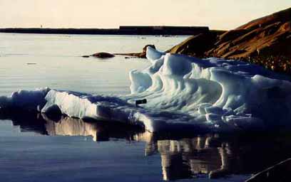
Hudson Bay is a relic of the Tyrrel Sea, the name given to an inland saltwater sea that existed in the Hudson Bay basin during and following the last glaciation. Theodora Stanwell-Fletcher describes a trip made by sailboat east along the bay from the harboour to the Fox Islands.
"As we rounded the Merry Rocks and headed along the coast which turns gradually eastward toward the Cape, all signs of Churchill and humanity receded in the distance. ... The rock Ridge wsoutheast of Churchill changed character gradually. First it was high and bare, interspersed with its tiny beaches;
"Farther on it was crowned with black lines of small spruce; then it dwindled and disappeared entirely in great sweeps of gravel and long beautiful sandy beaches that rose gently into dunes carpeted with dense green mats of plants like vivid grass, or blended into flat flower-filled tundra reaching away into the blue distance. ..."

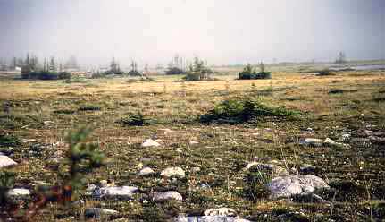
Evidence of permafrost can be seen the poorly drained land. Climate combines with this, with winter cold and strong winds to dwarf the plant species that exist there.
"Everywhere is evidence of an undeveloped drainage system. Shallow ponds of irregular outline, with abrupt mossy edges and no appreciable outlet, dovetail into each other on the broad, flat levels.
Permafrost Keeps Water from Soaking into the Ground.
Perpetual ice lies within three feet of the surface of the soil, dwarfing the trees by limiting their growth and forming an impevious substratum which prevents the ground seepage that should develop drainage channels. Every hollow, whether in porous moss or dense clay, holds water like solid rock, and this water, instead of cutting through permeable retaining ridges, tends to build them up with ice-formed dams, preventing rather than developing outlets.
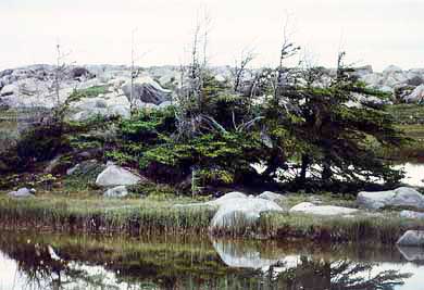
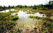
Boreal Pond
The tundra ponds are of the clearest water, with clean, firm, gravel bottoms and without vegetable growth."--Taverner Sutton. The birds of Churchill, Manitoba. Annals of the Carnegie Museum 23: 1-83. reprinted in Encounters on Hudson Bay, Brandson and Chartier.
Go to Ecology
Return to Reasons for Visiting Churchill
Return to Churchill Canada Intro Page